
Transforming Mining Operations Through Intelligent Surveillance Satellite Mining View
Harnessing Satellite & AI Technology to Ensure Transparency, Compliance, and Efficiency.

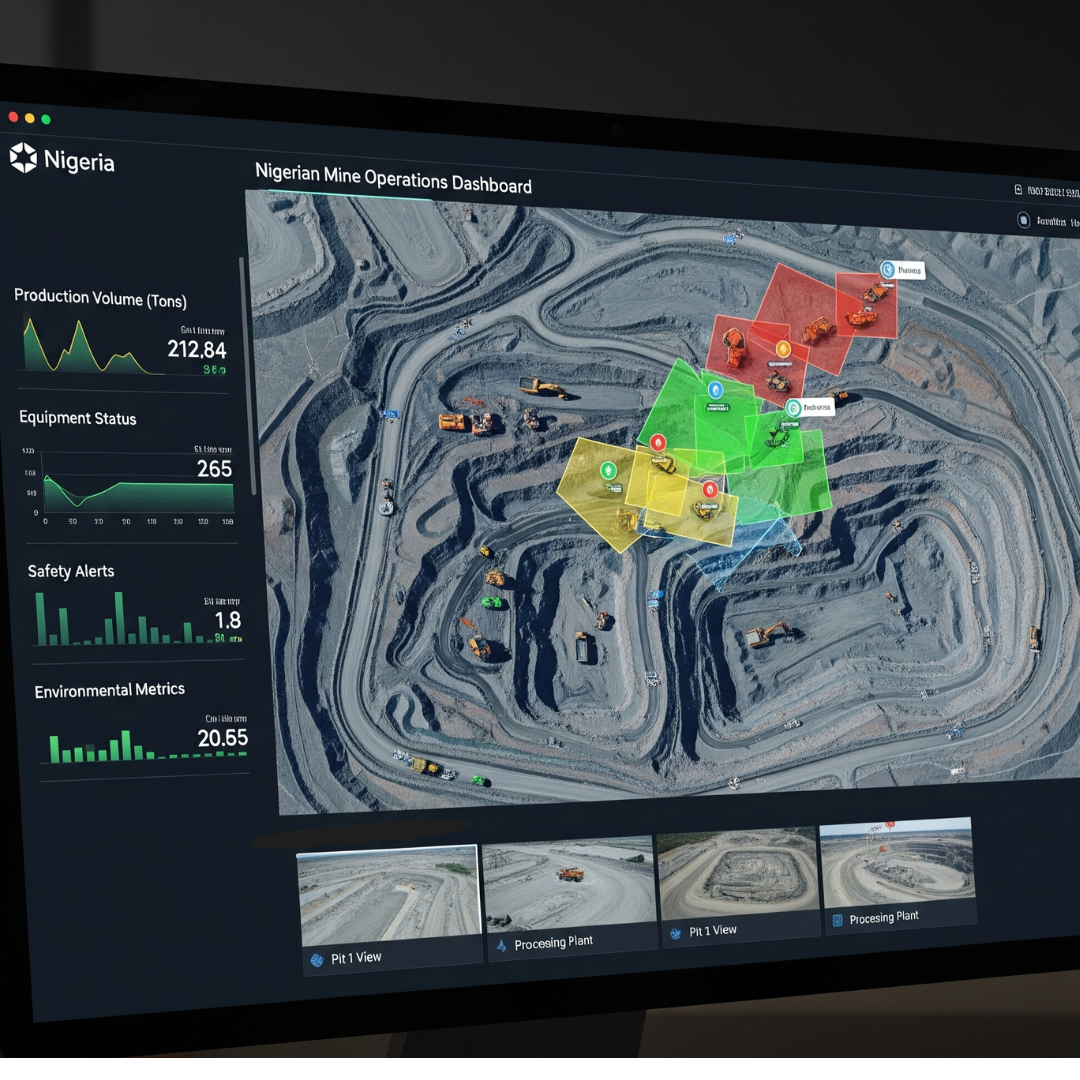
Our Core Capabilities
Multi-Sensor Satellite Remote Sensing
Leveraging advanced satellite imagery and data analysis for comprehensive monitoring of mining sites from space.
Integrated UAV Surveillance
Deploying state-of-the-art drones for high-resolution aerial inspections, mapping, and data collection on-site.
AI-Based Change Detection & Analytics
Utilizing machine learning algorithms to detect subtle changes, predict trends, and provide actionable insights.
Ready to Modernize Your Mining Operations?
Contact us today to discover how our satellite and AI solutions can enhance transparency and efficiency in your projects.
Exploration and Resource estimation
Identifying high-potential areas of mineral deposits and improving the accuracy of resource estimation are critical steps in enhancing the efficiency and effectiveness of mineral exploration and development.
Mine Planning and Design
Assessing the economic and environmental impact, along with optimizing operations planning, is essential for ensuring sustainable and cost-effective resource development strategies.
Mining Operations
Optimizing asset management, reducing equipment downtime, and enabling efficient predictive maintenance are key strategies for enhancing operational reliability, minimizing costs, and extending the lifespan of critical infrastructure and machinery.
Mine Rehabilitation and Reclamation
Environmental footprint monitoring and reporting, along with identifying environmental hazards, are vital for ensuring regulatory compliance, promoting sustainability, and mitigating potential ecological risks associated with industrial activities.
Tailored Solutions for Diverse Needs
Governments & Regulatory Bodies
Ensure compliance and resource management.
Mining Firms
Optimize operations and reduce risks.
Security & Law Enforcement
Enhance security and prevent illegal activities.
Why Choose Milky-Way Visuals Ltd?
- Several earth observation satellites via global partnerships
- Vertical integration across satellite, drone, and sensor technologies
- Logistics chain tracking with end-to-end geo-verification
- Scalable for governments, mining firms, security agencies, and ESG stakeholders
- Proven across mineral intelligence, enforcement, and export validation projects